Quick Navigation
- The Old Man of Hoy: Orkney’s Signature Walk
- Coastal Cliff Walks: Yesnaby, Marwick Head and Mull Head
- Yesnaby Cliffs and the Castle of Yesnaby
- Marwick Head and the Kitchener Memorial
- Mull Head, the Gloup and the Brough of Deerness
- The Brough of Birsay: A Walk Across the Sea Floor
- Wideford Hill and Ward Hill: The Inland Climbs
- Wideford Hill from Kirkwall
- Ward Hill: The Highest Point in Orkney
- Hobbister RSPB: A Quiet Moorland Circular
- The St Magnus Way: A 58-Mile Pilgrimage Path
- A Four-Day Orkney Walking Itinerary
- Weather, Kit and Safety on Orkney’s Trails
- Frequently Asked Questions
- What is the best walk in Orkney?
- How long is the walk to the Old Man of Hoy?
- What is the highest hill in Orkney?
- Is the Brough of Birsay accessible at all times?
- How long is the St Magnus Way?
- Do you need a guide for walking in Orkney?
- When is the best time of year to walk in Orkney?
- What should I wear walking in Orkney?
- Sources & further reading
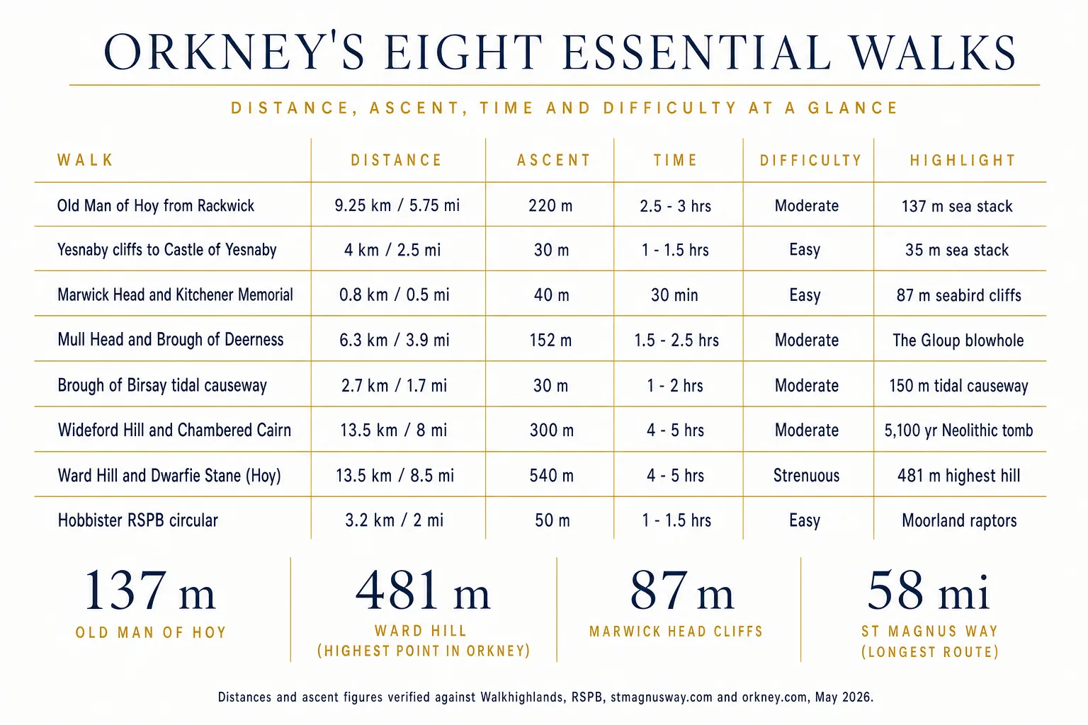
Orkney does not have mountains. What it has is something better — 481 metres of windswept hilltop, a 137-metre red-sandstone sea stack you can stare at across a 60-metre gap of open water, an 87-metre seabird cliff alive with kittiwakes in June, and a 58-mile pilgrimage path that ends at one of the finest cathedrals in northern Europe. The walking here is mostly coastal, mostly clear-pathed, and almost entirely free. This guide maps the eight essential routes — with verified distances, ascent figures and times taken from Walkhighlands, RSPB and the Orkney tourist board — plus the practical detail (tide windows, ferry timings, what to wear) that turns a planned walk into a finished one.
The Old Man of Hoy: Orkney’s Signature Walk
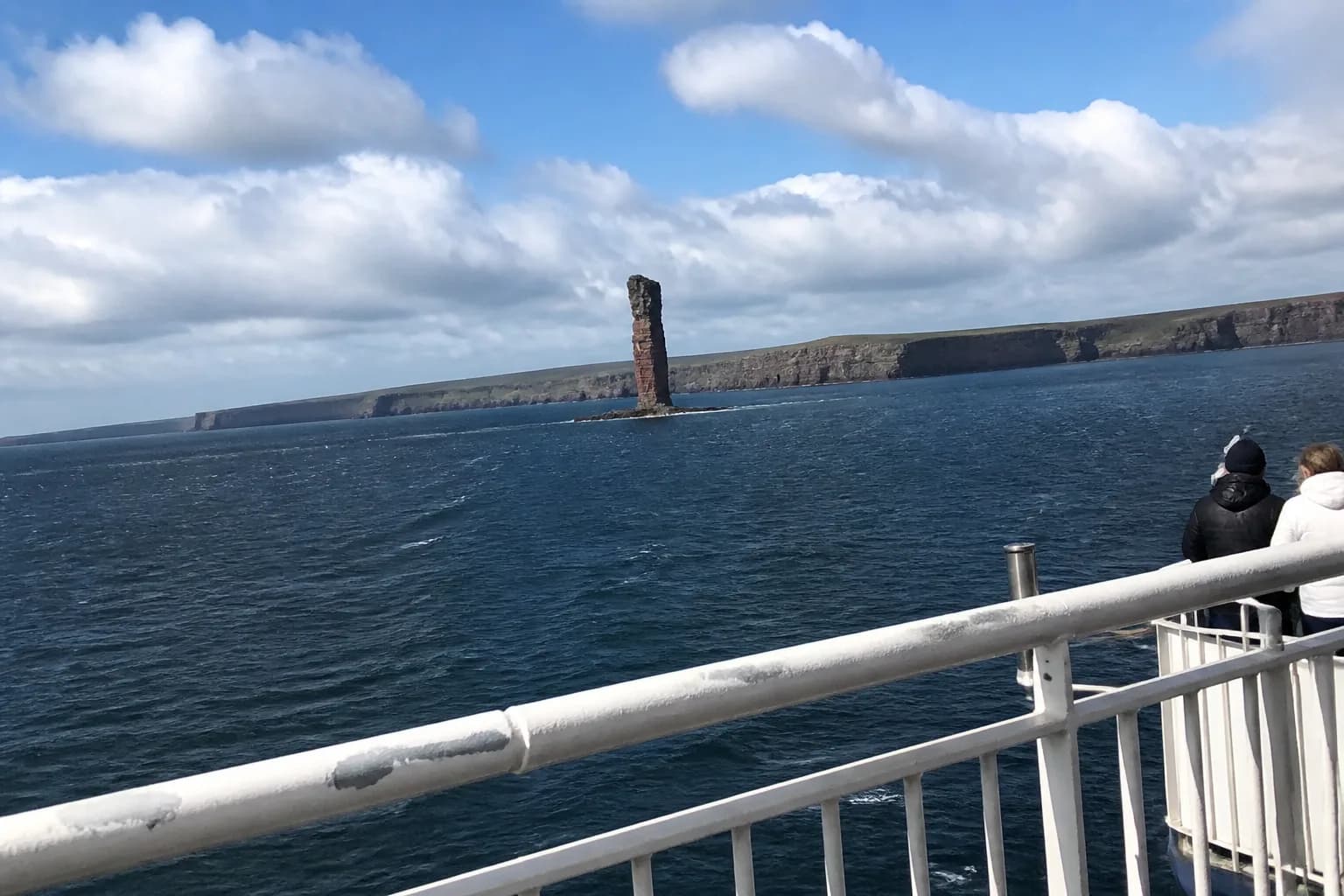
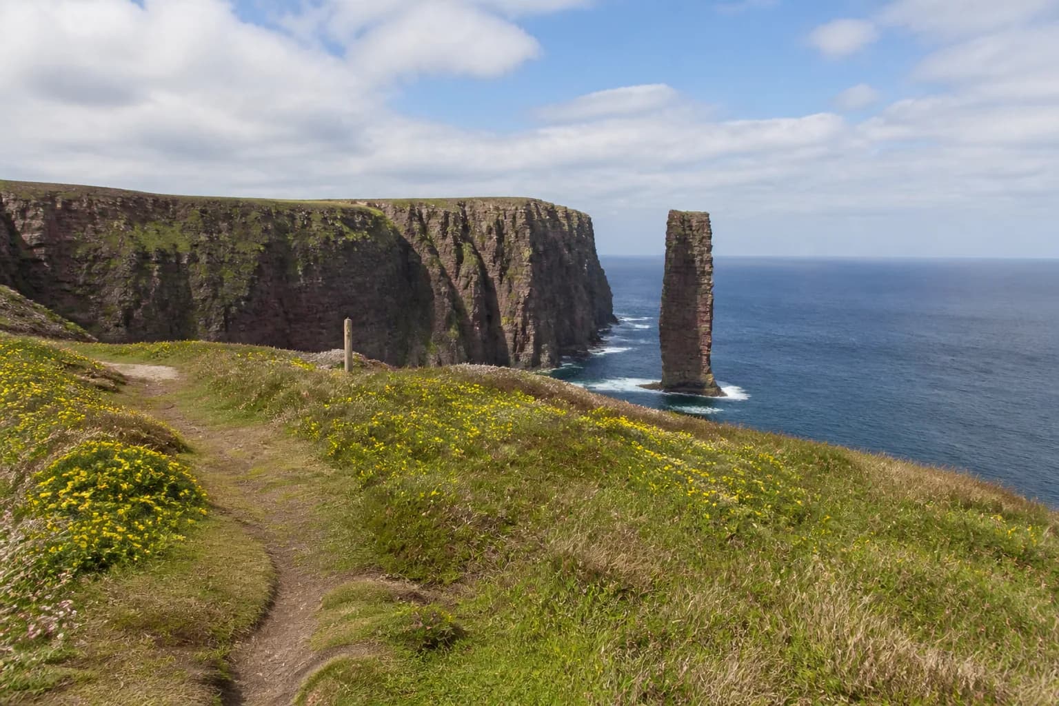
If you only walk one route in Orkney, walk this one. The clifftop path from Rackwick on the west of Hoy out to the viewpoint of the Old Man of Hoy is 9.25 km / 5.75 miles return, with 220 metres of ascent and 2.5 to 3 hours of walking. Walkhighlands grades it 2 out of 5 boots with a bog factor of 4.5/5 — a clear path, stony in places, but exposed along the cliff edge.
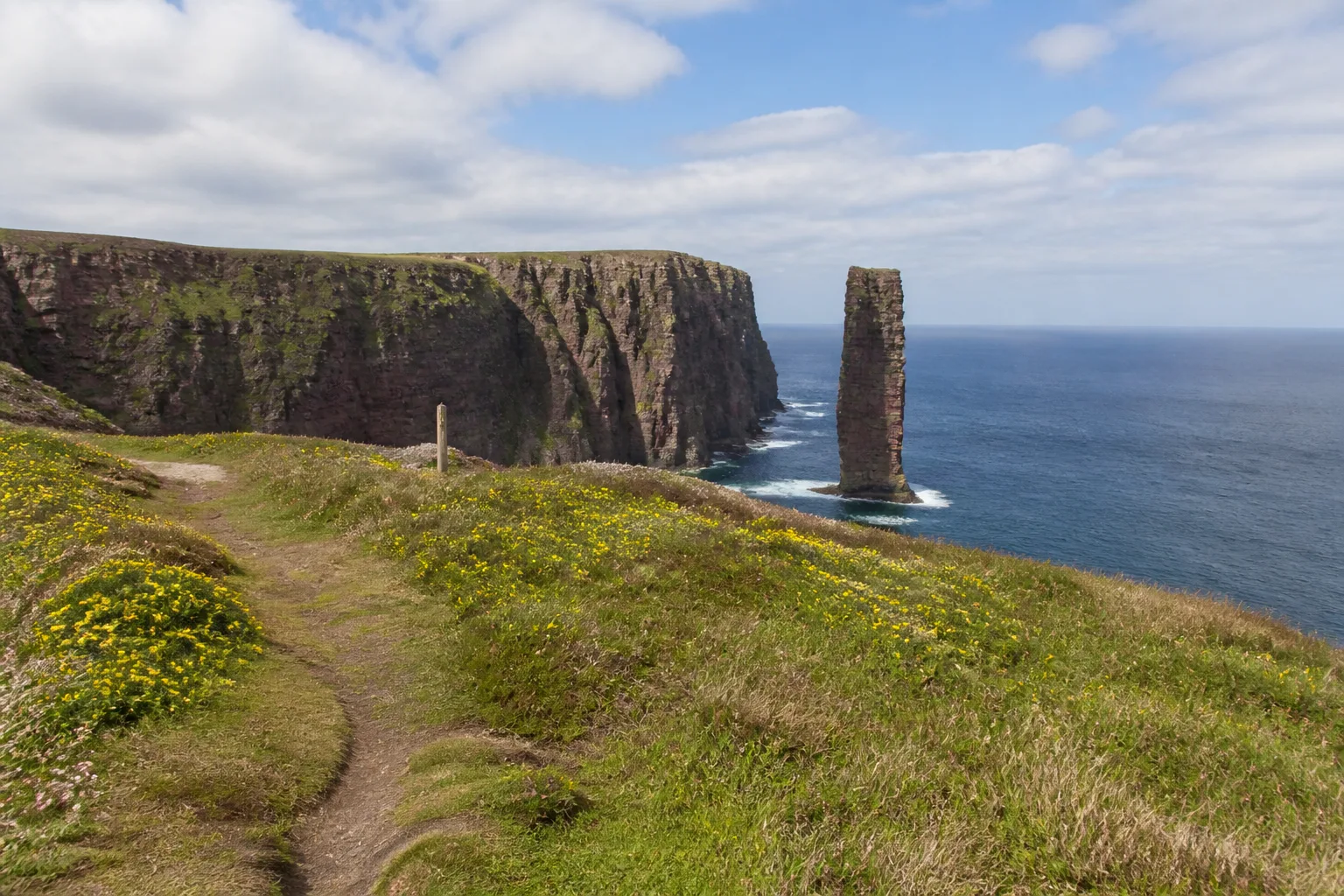
The path leaves the Rackwick car park, climbs steadily north-west for the first kilometre through croft fields, then breaks out onto the cliffs proper. The reveal — coming over the rise to see the stack standing offshore for the first time — is one of the great visual moments of any Scottish walk. The viewpoint is around 4 km from the car park, so most walkers turn here and return the same way. Strong walkers can extend the route along the cliffs to the wider Hoy circuit taking in the Cuilags summit.
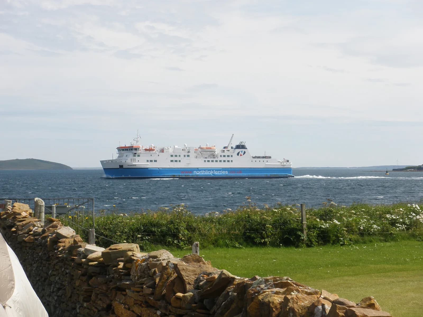
The walk is best done April to September. Ferries to Hoy run from Houton (vehicle ferry, ~30 min) and Stromness (passenger ferry to Moaness, ~25 min) — the passenger ferry is the practical option if you’re walking only. Pre-book in summer; the Sunday timetable is reduced.
Coastal Cliff Walks: Yesnaby, Marwick Head and Mull Head
Most of Orkney’s best walking is coastal — the Old Red Sandstone cliffs of the west coast give you sea stacks, geos, blowholes, seabird colonies and the kind of clean horizon that does not exist in mainland Britain. Three short to moderate walks together cover the full range of what the coast offers.
Yesnaby Cliffs and the Castle of Yesnaby
Yesnaby lies six miles north of Stromness and is the shortest serious cliff walk on Mainland Orkney. From the World War II lookout car park, the cliff path heads south for roughly 20 minutes to reach the Castle of Yesnaby — a delicate 35-metre sea stack with a natural arch at its base, resting on a split rock pedestal. Extending further south to the 52-metre Castle of North Gaulton brings total walking to around 4 km / 2.5 miles, roughly 1 to 1.5 hours.
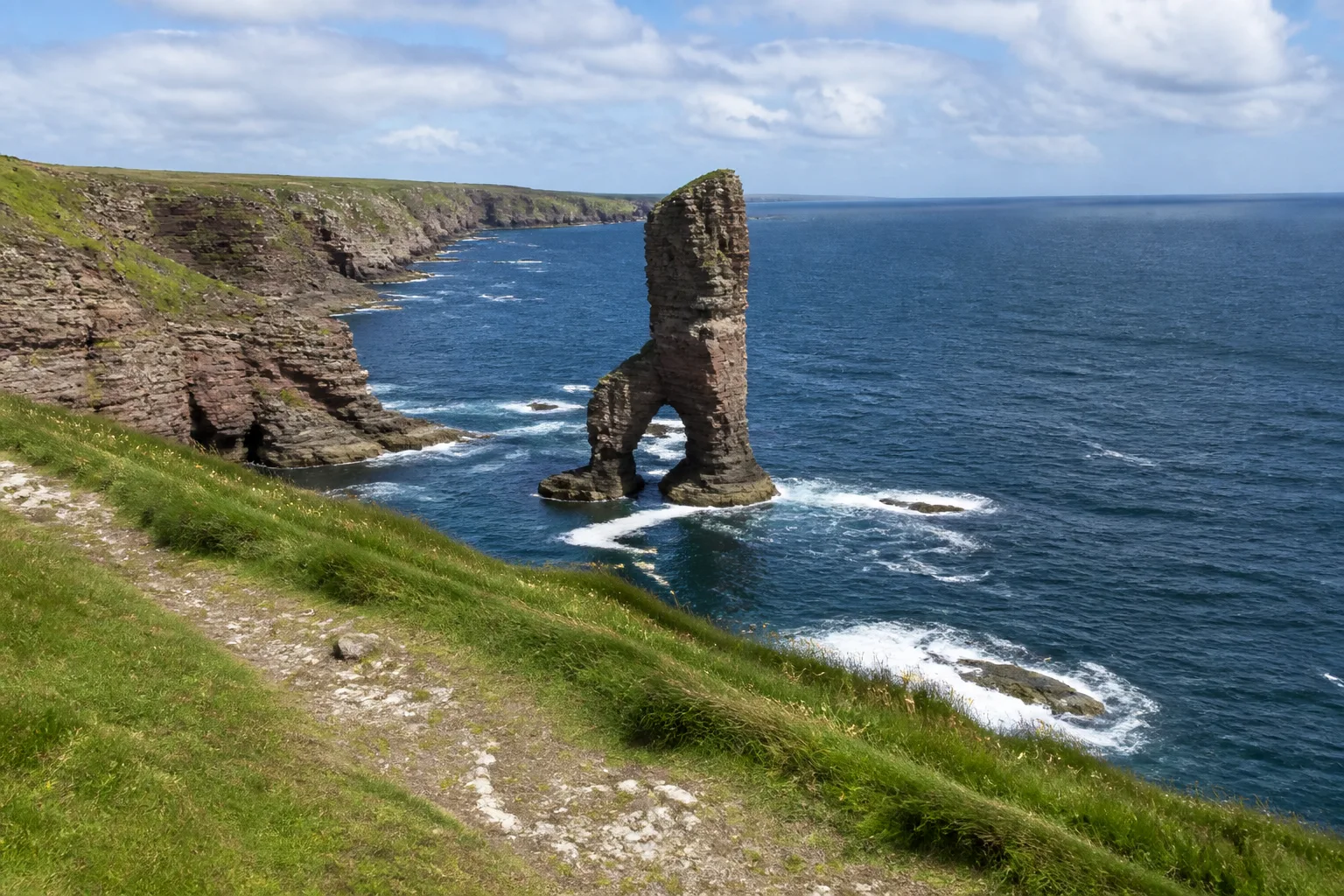
This is the easiest of Orkney’s "name" cliff walks. The path is mostly level (peninsula highest point ~31 m), the parking is right at the start, and the headline view comes within fifteen minutes of leaving the car. Wear something windproof — Yesnaby is unsheltered on every side — and stay back from the eroding edge. For an in-depth tour of Orkney’s dramatic sea cliffs beyond this walk, the full west coast continues in geos and inlets all the way to Marwick Head.
Marwick Head and the Kitchener Memorial
Marwick Head on the West Mainland is Orkney’s most accessible seabird cliff and the easiest "big view" walk on the islands. From the Cumlaquoy car park the path runs roughly 800 m / half a mile along the clifftop to the Kitchener Memorial — a 48-foot (~15 m) crenellated stone tower unveiled in 1926 in memory of Field Marshal Lord Kitchener and the 737 men of HMS Hampshire, which sank off the cliffs in June 1916. In June 2016 a curved granite memorial wall was added by Orkney Heritage Society listing every name lost. Total walking: 30 minutes to an hour.
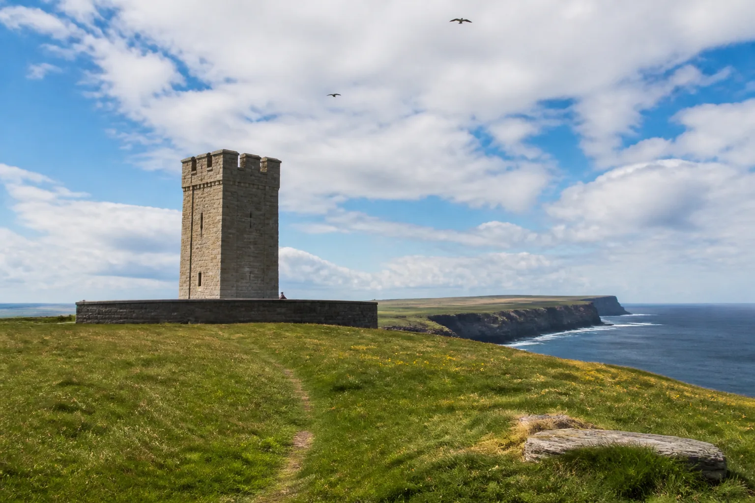
The walk is best from April through July when the 87-metre cliffs are full of nesting seabirds: kittiwakes, guillemots, razorbills, fulmars, puffins and rock doves. By August most of the seabirds have left. The viewpoint at the memorial looks straight down into the seabird colony — sit quietly for five minutes and the noise alone is worth the trip. For walkers who want more of the same, our seabird-by-month guide shows where each species is most visible.
Mull Head, the Gloup and the Brough of Deerness
The Mull Head Nature Reserve on the eastern tip of Mainland Orkney is the best single circular walk on the islands — 6.75 km / 4.25 miles, 196 m ascent, 2 to 3 hours, grassy clifftop with a boggier inland return. It packs in everything: a Norse blowhole, an early-medieval chapel ruin on a sea stack, and uninterrupted views to Copinsay and the open North Sea.
Two highlights to slow down for:
- The Gloup — just 200 yards from the car park, a deep collapsed sea cave whose roof fell in at some point in geological time. The name is Norse and the locals will tell you it’s the islands’ oldest blowhole. Lean over the safety rail and you can hear the surf below.
- The Brough of Deerness — a 30-metre flat-topped sea stack reached by a slightly exposed path with a chain handrail. On top: the stone footings of a late-Norse chapel from the 11th or 12th century. Skip the chain section if you don’t like exposure — the view from the cliff opposite is almost as good.
Planning your trip
Staying overnight? Compare live prices and availability across Orkney on Booking.com.
Compare Orkney staysWe earn a small commission if you book through this link, at no extra cost to you.
The Brough of Birsay: A Walk Across the Sea Floor
The Brough of Birsay is the most unusual walk on Orkney — a 150-metre causeway of seaweed-covered concrete and natural rock that lies under several metres of water for most of every day and reveals itself only at low tide. The full circuit is 2.7 km / 1.7 miles with around 30 m of ascent and takes 1 to 2 hours depending on how long you stay on the island to explore the Norse village ruins, the 12th-century St Peter’s Church and the white lighthouse.
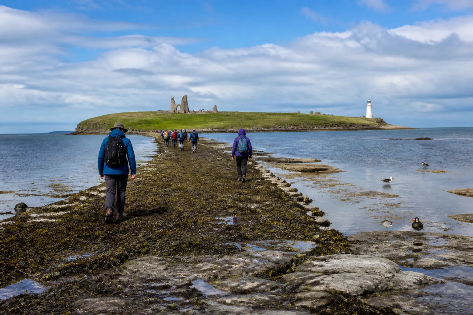
The non-negotiable rule: cross only within two hours either side of low tide. Tide tables for Birsay Bay are posted at the causeway car park, on the Met Office website and on tideschart.com. Aim to cross at least an hour before low water so you have a full window on the island. The tide comes in fast — walkers do get stranded every summer.
Wear proper footwear: the wet rock and seaweed are slippery enough to put unprepared visitors on their backside in the first ten metres. On the island, the looped clifftop circuit past the lighthouse adds another kilometre with very modest ascent and brilliant views back across the bay to the Mainland.
Wideford Hill and Ward Hill: The Inland Climbs
Orkney isn’t a hill-walking destination in the Munro sense — the highest summit doesn’t reach 500 metres. But the two big hill walks earn their reputation. Both deliver disproportionately big views, and both can be done from Kirkwall or Stromness as half- or full-day outings.
Wideford Hill from Kirkwall
Wideford Hill rises 225 metres above the western edge of Kirkwall and is the easiest summit on Orkney to reach on foot. The full Walkhighlands route from the Pickaquoy Centre is 9.75 km / 6 miles with 308 m / 1,010 ft of ascent — an easy two and a half to three hours. The summit carries a trig point and a view indicator, with the entire Mainland visible on a clear day, plus Shapinsay, Rousay and Hoy.
The return route is the real prize: it drops over the far side of the hill to the Wideford Hill Chambered Cairn, a 5,100-year-old Neolithic tomb that you can crawl inside (bring a torch). Wideford pre-dates the Egyptian pyramids by roughly 600 years. If you only have a half-day in Orkney and want to combine a hill, a view and Neolithic Orkney in one walk, this is it. Walkers based in central Kirkwall can be at the trailhead in 15 minutes on foot.
Ward Hill: The Highest Point in Orkney
Ward Hill on Hoy is the summit of the Orcadian archipelago — 481 m / 1,578 ft, the highest point in both Orkney and the Scottish Northern Isles. The Walkhighlands route pairs Ward Hill with the Dwarfie Stane, a rock-cut Neolithic tomb hewn into a single block of sandstone at the foot of the hill. Total: 12 km / 7.5 miles, 520 m of ascent, 4–5.5 hours, 3 out of 5 boots, as a circuit from Moaness Pier. The ascent above the Dwarfie Stane is described by Walkhighlands as "relentless and extremely steep" — treat this as a real hill day, not a Sunday stroll.
In return, you get something no other Orkney walk offers: the full horizon, from Sutherland in the west to Shetland weather on the north skyline on a clear day, and the chance to see Ward Hill’s famous summer arctic skuas wheel overhead.
Hobbister RSPB: A Quiet Moorland Circular
For walkers who want wildlife rather than altitude, Hobbister RSPB Reserve on the south side of Orphir is the best easy circular on the Mainland. The waymarked trail is 2 miles / 3.2 km with around 50 m of ascent, takes 1 to 1.5 hours and runs from heather moorland down to Scapa Flow at Waulkmill Bay and back.
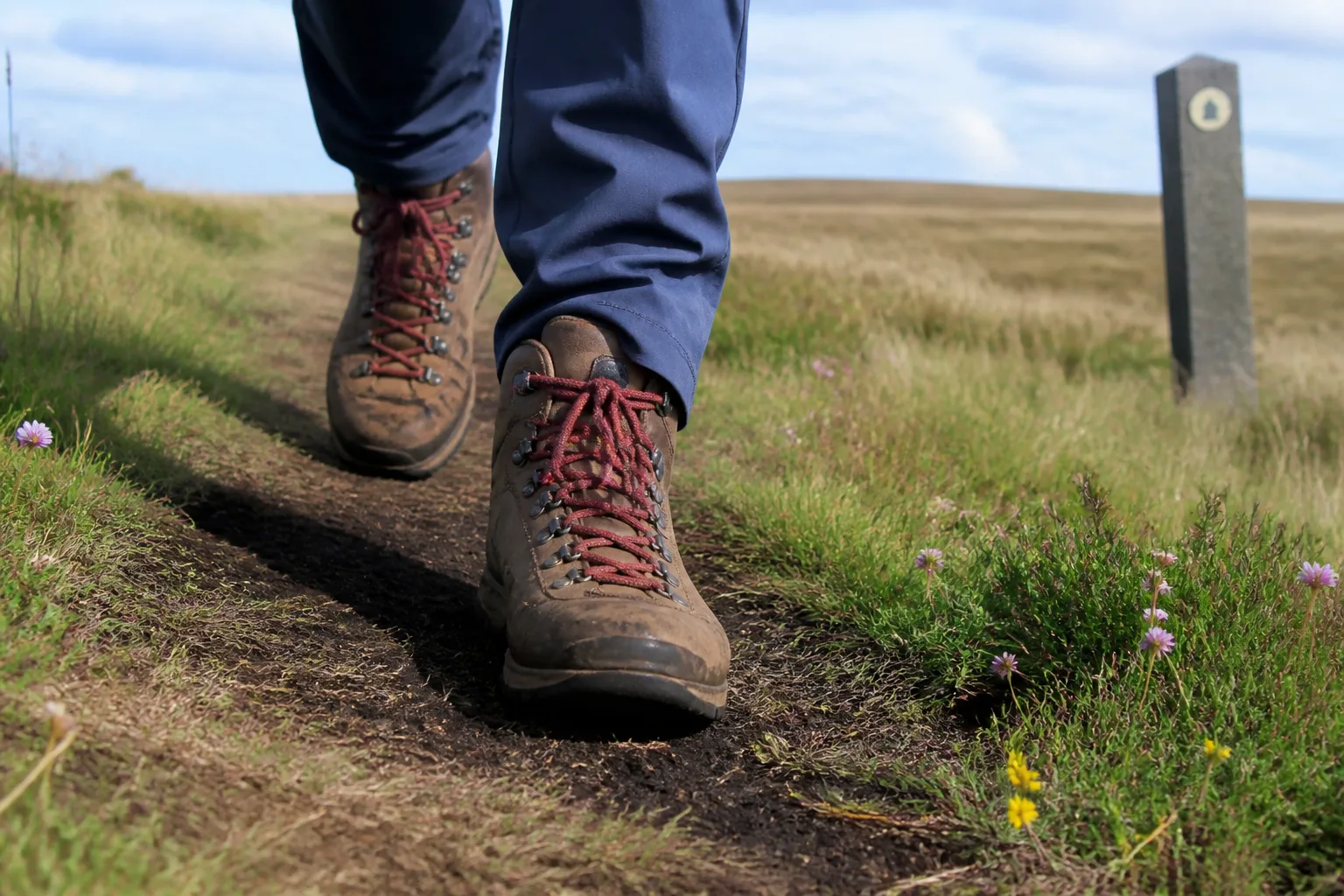
What Hobbister offers that the cliff walks don’t: moorland raptors. The reserve is a known territory for hen harriers, short-eared owls and red-throated divers, with red-breasted mergansers and black guillemots on the coastal section. Best visited dawn or dusk between April and August; the path is rough peat and frequently wet, so plan for proper boots and a slow pace. Free entry, free parking, no facilities.
The St Magnus Way: A 58-Mile Pilgrimage Path
The St Magnus Way is Orkney’s only formal long-distance route — a 58-mile (~90 km) pilgrimage path across Mainland Orkney in six sections, following the journey of St Magnus from his martyrdom on Egilsay in 1117 to his shrine in St Magnus Cathedral, Kirkwall. The route opened in 2017 and is waymarked throughout.
Walking schedule: 4 good days, 5 gentler days, or 3 intensive days for hardened distance walkers. The route designers recommend walking it in shorter 3- to 4-mile sections over a longer trip — treat it as a thread to follow rather than an endurance challenge. The six sections each have a distinct character:
- Egilsay — the start point on the island where St Magnus was killed in 1117. Reached by ferry from Tingwall on the Mainland.
- Evie to Birsay — rough coastal walking on the Mainland's north-west coast.
- Birsay to Dounby — inland tracks and minor roads through farmland.
- Dounby to Finstown — a short forest section through Binscarth Wood, almost the only woodland walking on Orkney.
- Finstown to Orphir — rough heather moorland over Cuween Hill and the Hill of Lyradale.
- Orphir to Kirkwall — the final leg, routing through the Waulkmill RSPB reserve at Hobbister, into the cathedral.
Full maps and section notes are at stmagnusway.com/route. The Rucksack Readers pocket guide (St Magnus Way, 2018) is the standard printed companion and folds into a coat pocket.
A Four-Day Orkney Walking Itinerary
You can sample all eight walks in a focused four-day visit if you base yourself in Kirkwall or Stromness and accept that the Hoy days need ferry slots booked.
Add a fifth day for Ward Hill if you’re a confident hill walker — it’s a full day on Hoy with a separate ferry booking. The Stromness base also gives you Hoy ferry access without driving on the morning of the walk, and self-catering flats and holiday homes in Stromness are the obvious place to start looking; see our first-timer’s planning guide for more detail on basing decisions, weather windows and what to pack.
Weather, Kit and Safety on Orkney’s Trails
The walking is less technical than the Highlands but the conditions are harder than visitors expect. Three things matter more than anywhere else in Scotland:
- Wind. Even a "calm" Orkney day will deliver 20–30 mph on an exposed clifftop. Carry a proper windproof outer, hat and gloves April to October — not optional. Skip cliff-edge walks entirely if winds are forecast above 40 mph.
- Tide. The Brough of Birsay causeway and several beach approaches close completely at high water. Check tide tables (Met Office or tideschart.com) the night before, not the morning of.
- Path conditions. Orkney soils are peat over sandstone — the moorland sections of Hobbister, the inland Mull Head return and the Magnus Way are reliably wet underfoot. Waterproof boots, not trail runners.
Mobile signal is patchy on the outer cliffs (Yesnaby, Marwick, Mull Head). Tell someone where you’re walking and when you’ll be back. Carry a paper map for any walk over 5 km — OS Explorer 461 (East Mainland) and 463 (West Mainland) cover the Mainland; OS Explorer 462 covers Hoy, South Walls and Flotta.
Frequently Asked Questions
What is the best walk in Orkney?
The walk to the Old Man of Hoy from Rackwick on the island of Hoy is the most popular and most photographed walk in Orkney. It is 9.25 km / 5.75 miles return with 220 metres of ascent, takes 2.5 to 3 hours and ends with the unobstructed view of the 137-metre Old Red Sandstone sea stack across a 60-metre gap of open water. Most walkers consider it the headline walk of any Orkney visit.
How long is the walk to the Old Man of Hoy?
The standard return walk from Rackwick car park on Hoy to the Old Man of Hoy viewpoint is 9.25 km / 5.75 miles, with 220 metres of ascent and 2.5 to 3 hours of moving time. The path is clear and stony in places but exposed along the cliff edges. Walkhighlands rates it 2 out of 5 boots.
What is the highest hill in Orkney?
Ward Hill on Hoy is the highest point in Orkney and in the Scottish Northern Isles at 481 metres / 1,578 ft. The Walkhighlands circuit from Moaness Pier visits the Dwarfie Stane Neolithic rock-cut tomb at the foot of the hill before making an extremely steep ascent to the summit, returning by the glen path. Total: 12 km / 7.5 miles, 520 m of ascent, 4 to 5.5 hours, 3 out of 5 boots.
Is the Brough of Birsay accessible at all times?
No — the Brough of Birsay is a tidal island reached by a 150-metre causeway that is only exposed within roughly two hours either side of low tide. Outside that window the causeway is submerged and the tide is strong enough to be dangerous. Check tide times at the Met Office website or at tideschart.com before driving out to Birsay. The crossing itself is short but the seaweed-covered rock is slippery.
How long is the St Magnus Way?
The St Magnus Way is a 58-mile (approximately 90 km) waymarked pilgrimage route across Mainland Orkney in six sections, starting from the island of Egilsay where St Magnus was martyred around 1117 and ending at his shrine in St Magnus Cathedral, Kirkwall. It can be walked in 3 intensive days, 4 standard days or 5 gentler days, and the route designers encourage walking it in shorter 3- to 4-mile sections.
Do you need a guide for walking in Orkney?
No — almost every recommended walk in Orkney is well-waymarked and follows clear coastal paths or moorland tracks. Detailed free route notes are published on Walkhighlands for most major Orkney walks, including the Old Man of Hoy, Marwick Head, Mull Head, Ward Hill, Wideford Hill and the Brough of Birsay; the St Magnus Way has its own route notes at stmagnusway.com. The RSPB also publishes leaflets for the Marwick Head and Hobbister reserves. A paper map (OS Explorer 461, 462 and 463) is still recommended for any walk over 5 km.
When is the best time of year to walk in Orkney?
May to early September is the prime walking season. June offers the longest daylight (sunset after 10pm) and peak seabird activity on the cliffs — puffins, kittiwakes, guillemots and razorbills are all on the nesting cliffs at Marwick Head and Mull Head. April and September are quieter and often drier but seabird viewing falls off. Avoid winter walks on the outer cliffs unless you’re a confident winter walker — the wind alone makes cliff edges dangerous.
What should I wear walking in Orkney?
Even in mid-summer, pack a windproof shell, warm mid-layer, hat, gloves and waterproof boots for every walk over 3 km. Trail runners are not enough for the peaty moorland on Hobbister, the inland sections of Mull Head or the Magnus Way. The wind on exposed cliffs (Yesnaby, Marwick, Old Man of Hoy) is consistently 20–30 mph even on calm days — a windproof outer is non-optional, not a precaution.
The Orkney trails are unusual in that you can do almost all of them on a four-day visit, almost all on free public paths, and almost all with no crowds. Plan around the ferry timetables for Hoy, the tide windows for Birsay, and the weather for the exposed cliffs — everything else falls into place. The mainland route from Kirkwall puts you within twenty minutes of seven of the eight walks listed here, which is why most walkers base in or near the capital.
Sources & further reading
The facts in this guide were checked against the following authoritative sources.
- The Old Man of Hoy from Rackwick — Walkhighlands — distance, 220 m ascent, time and grade for the headline walk
- Mainland Orkney walks — Walkhighlands — route statistics for Wideford Hill, Mull Head, Marwick Head and the Brough of Birsay
- Finstown to Orphir — St Magnus Way — Hobbister/Waulkmill falls on Orphir-Kirkwall section
- Camping — Scottish Outdoor Access Code — hillwalking and camping access rights
- Walking in Scotland — VisitScotland — Scotland walking routes and safety guidance
- Hoy Nature Reserve, Orkney — RSPB — Old Man of Hoy area wildlife and access