Quick Navigation
- The West Mainland loop at a glance
- Brough of Birsay: timing the tide
- The Earl's Palace, Birsay
- Barony Mill and the last of the bere
- Marwick Head and the Kitchener Memorial
- The Bay of Skaill, Skara Brae and Skaill House
- Driving the West Mainland: what to expect
- Where to base yourself for the West Mainland
- West Mainland road trip: frequently asked questions
- When can you cross to the Brough of Birsay?
- How long does it take to drive around the West Mainland of Orkney?
- Do you need a car to see the West Mainland?
- Where do you park for Marwick Head and the Kitchener Memorial?
- How far is Skara Brae from Stromness?
- Can you visit Barony Mill?
A West Mainland Orkney road trip is one of the few drives in Britain where the timetable is set by the moon. The stops are close together and the roads are quiet, but the best of them, the Brough of Birsay, is a tidal island you can only walk to for about two hours either side of low water. Get that window right and the rest of the day falls into place: a Neolithic village, a roofless earl's palace, a water mill still grinding barley, and a cliff-top tower to 737 men who never came home. Get it wrong and you stand on the shore looking at it.
The West Mainland loop at a glance
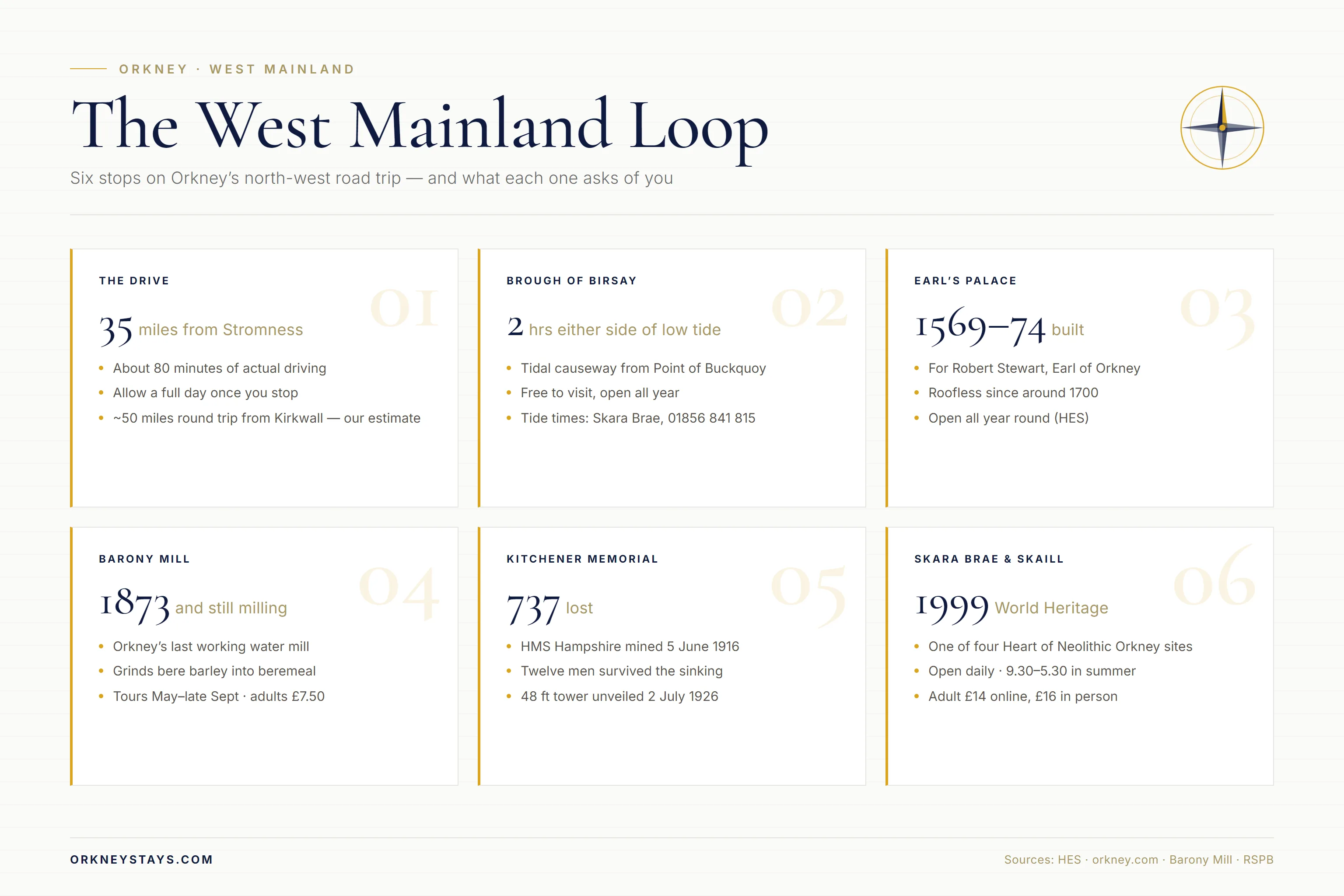
The whole circuit is small. From Stromness it is roughly 35 miles of driving, about 80 minutes at the wheel if you never stopped, which of course you will. From Kirkwall the same loop runs to about 50 miles and around an hour and three quarters of driving. Neither number is the point. The point is that you can see five genuinely significant places in a day without ever being more than half an hour from a bed.
| Stop | From the last one | What it asks of you |
|---|---|---|
| Skara Brae & Skaill House | 7.6 miles from Stromness | Timed ticket, allow 90 minutes |
| Marwick Head & Kitchener Memorial | 6 miles | A cliff walk from the car park |
| Brough of Birsay | 4 miles | Low tide, and only low tide |
| Earl's Palace, Birsay | 1 mile | Twenty minutes, free, any time |
| Barony Mill | 1 mile | A 30-minute tour, May to September |
| Dounby and back south | 7 miles | Fuel, shop, and the road home |
Two things decide the order you drive it in. The first is the tide at Birsay. The second is whether you have a ticket for Skara Brae, which is timed. Everything else on the list is either free and unstaffed or open through the middle of the day, so the sensible approach is to fix those two appointments first and let the rest of the loop arrange itself around them.
One deliberate omission. The road that runs south from the Bay of Skaill towards Yesnaby is worth driving, and the cliffs at the end of it are the most dramatic on the Mainland, but they are a walk rather than a stop and they deserve more room than a road-trip guide can give them. We have written about Yesnaby and Orkney's other sea cliffs separately, and if the weather is behaving it is an easy add-on to this loop.
Brough of Birsay: timing the tide
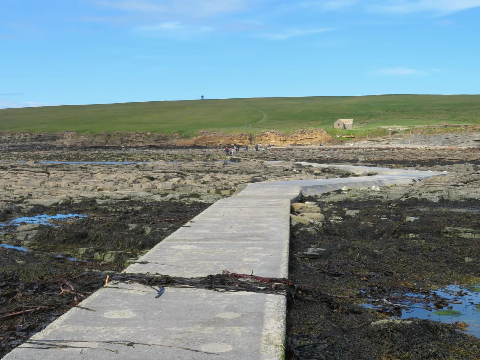
The Brough is a green tidal island off the north-west corner of the Mainland, joined to the Point of Buckquoy by a concrete causeway that spends most of the day underwater. VisitOrkney puts the access window at around two hours either side of low tide, and warns plainly that the tide comes in quickly and that you can easily become stuck. Historic Environment Scotland, which cares for the site, adds that the causeway is rocky and can be slippery, and recommends strong footwear. Take both at face value.
Check the tide before you leave, not when you arrive. Historic Environment Scotland points visitors to the Met Office tide predictions or to the Skara Brae visitor centre on 01856 841 815, which is a useful call to make anyway if you are ticketing Skara Brae the same day. Cross early in your window rather than late, and give yourself more time coming back than you think you need.
What is on the island justifies the planning. The Norse settlement is the clearest you will see anywhere in Scotland: house walls, barns, and a sauna. Above them stands the church of St Peter, which Historic Environment Scotland describes as a sophisticated building with a square tower and glazed windows, extraordinary for twelfth-century Orkney. A replica Pictish symbol stone marks where the original was found, and a small lighthouse sits at the crest of the island where the land tips over into the Atlantic. Walk to the far side and the cliffs are full of nesting birds in early summer.
Planning your trip
Staying overnight? Compare live prices and availability across Orkney on Booking.com.
Compare Orkney staysWe earn a small commission if you book through this link, at no extra cost to you.
The Earl's Palace, Birsay
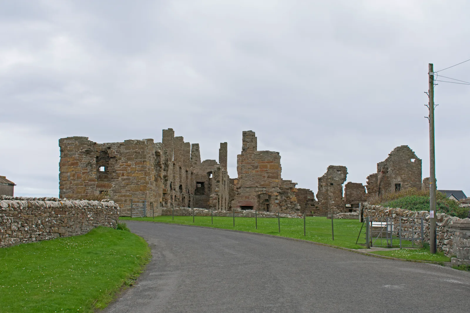
Five minutes back along the shore road, in the village itself, sits the shell of one of the strangest buildings in Scotland. The Earl's Palace was built between 1569 and 1574 for Robert Stewart, an illegitimate son of James V who became Earl of Orkney and ran the islands as a private fiefdom. Historic Environment Scotland calls it a fine courtyard castle that remains in a remarkable state of completeness, which is fair: it has been roofless since around 1700 and the walls still stand to full height, with the window and doorway openings intact.
It costs nothing, there is nobody to pay, and it is open all year. Twenty minutes is enough to walk the courtyard and read the interpretation boards, and it works well as the thing you do while you wait for the tide to drop at the Brough, which is a mile up the road. The toilets in the village are the nearest public ones for several miles in any direction, which matters more on this loop than it sounds.
Barony Mill and the last of the bere
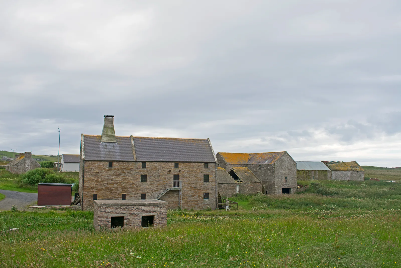
A mile inland from the palace, on the Boardhouse burn, is the best small visit in the West Mainland. Barony Mill was built in 1873 and has never stopped. It is Orkney's last working water mill, and it is the only place in the world grinding bere barley commercially into beremeal, the dark, nutty flour that Orcadian bannocks are made from. Bere is an ancient six-row barley that survives in a handful of fields in this corner of the islands and nowhere much else.
Birsay Heritage Trust, a Scottish charity, leases the mill from Orkney Islands Council and runs it. Tours go from May until late September, daily between 11am and 4pm, starting on the three-quarter hour: 11.00, 11.45, 12.30, 1.15, 2.00, 2.45 and 3.30. Each lasts about 30 minutes and takes a maximum of eight people, so book if you can. Adults were £7.50 when we checked in August 2026, children aged 7 to 15 £4.50, and under-7s free. The shop sells beremeal ground on site, which is the most portable souvenir on the island.
Marwick Head and the Kitchener Memorial
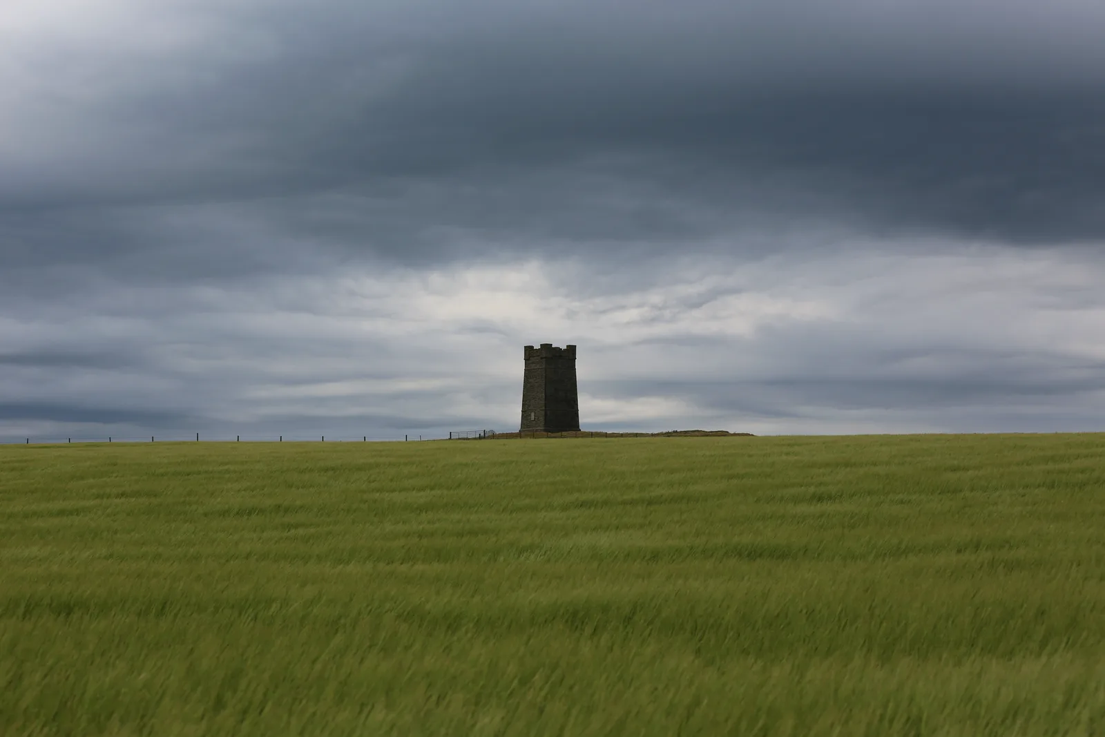
South of Birsay, a single-track road drops to Marwick Bay, and from the car park there a path climbs the cliff to a square stone tower. The RSPB manages the headland as a reserve and there is ample parking at Marwick Bay, with an alternative space for around six cars at Cumlaquoy. There are no toilets at either: the nearest are back at Palace Village in Birsay, four miles away, and the nearest accessible ones are at the Bay of Skaill, four miles south.
The tower is the Kitchener Memorial. On the evening of 5 June 1916 the cruiser HMS Hampshire struck a mine off this headland and went down in about fifteen minutes. Lord Kitchener, the Secretary of State for War, was aboard on his way to Russia. Of the 737 men lost, only twelve survived. The people of Orkney raised the money for the 48-foot tower themselves and it was unveiled on 2 July 1926. For the centenary in 2016 a low commemorative wall was added around its base, carrying the names of every man who died.
It is a fifteen-to-twenty minute walk up from the bay, steep in places and completely exposed. In early summer the cliffs below are loud with seabirds, and the memorial has the disconcerting quality of a war grave with a view. Go in the evening if you can.
The Bay of Skaill, Skara Brae and Skaill House
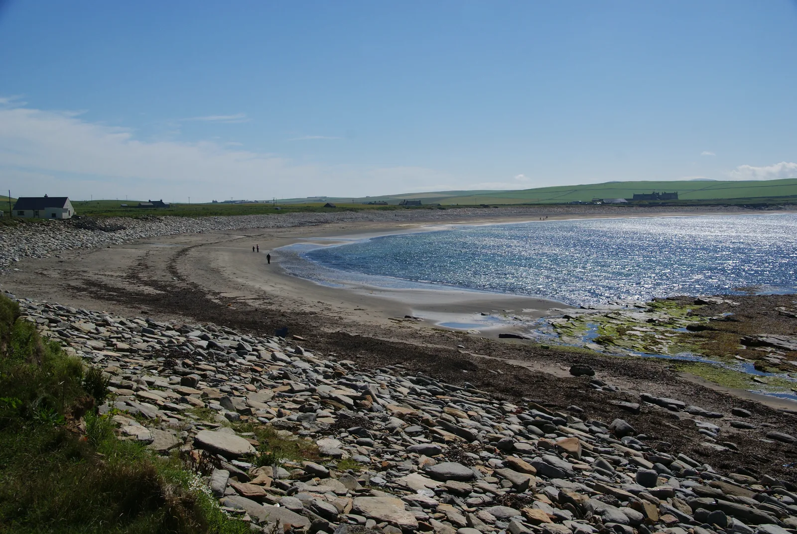
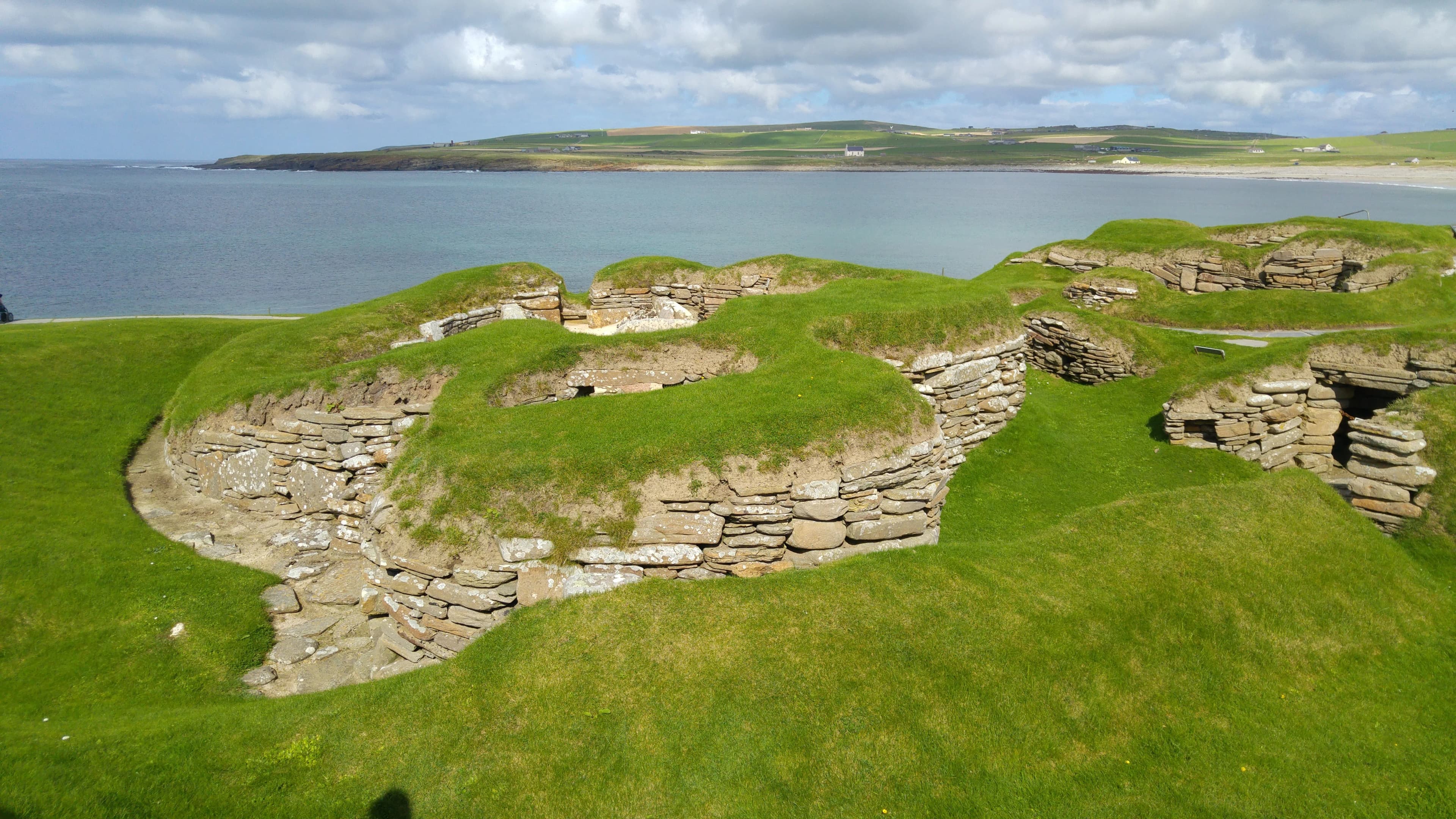
The southern end of the loop is the famous end. Skara Brae sits in the dunes at the back of the Bay of Skaill, a Neolithic village of stone houses and passages uncovered by a storm in 1850. It is one of the four monuments that make up the Heart of Neolithic Orkney, inscribed by UNESCO in 1999 alongside Maeshowe, the Stones of Stenness and the Ring of Brodgar. Historic Environment Scotland opens it daily, 9.30am to 5.30pm from 1 April to 30 September and 10am to 4pm through the winter. Adult tickets were £14 booked online and £16 bought in person in August 2026. Because it is the one timed appointment on this route, our full guide to visiting Skara Brae is worth reading before you book.
Skaill House stands immediately behind it, the seventeenth-century laird's mansion whose owner, William Watt, was the man who dug into the dunes after that 1850 storm. Its season is April to September, 10am to 6pm, and October, 10am to 4pm, seven days a week. Ticketing has moved around: Skaill House describes admission as a joint ticket with Skara Brae, while Historic Environment Scotland's page notes that the house is operated separately. Buy through the Skara Brae page and check what your ticket covers before you travel.
The bay itself is free, always open, and arguably the better half of the stop. It is a wide arc of pale sand with a loch behind it, and after a westerly blow the whole thing rearranges itself.
Driving the West Mainland: what to expect
These are small roads. The A967 and A986 are the spines of the loop and are properly surfaced two-lane roads, but almost every branch off them, including the ones to Marwick Bay and the Brough, narrows to single track with passing places. The etiquette is simple and non-negotiable: pull into the passing place on your left, or stop opposite the one on your right, and never park in one. Farm traffic has priority in spirit if not in law, and a tractor reversing a quarter of a mile because a hire car would not give way is a story that gets told in the shop.
Fuel is the practical catch. There is no filling station on the coast road between Stromness and Birsay, so fill up in Stromness, Dounby or Kirkwall before you start rather than assuming you will pass one. Dounby, roughly in the middle of the West Mainland, is where the shops and the fuel are, and it makes a sensible mid-loop resupply. Mobile signal is patchy along the Marwick and Birsay shore, so screenshot your tide times rather than relying on loading them at the causeway.
The light is the other thing nobody warns you about. In June there is usable daylight until well past 11pm, which turns this loop into an evening drive rather than a day trip, and the low sun off the Atlantic at Marwick and Birsay is the reason photographers keep coming back. In midwinter you have about six hours, which is enough for the loop but not for the loop plus a leisurely lunch.
Where to base yourself for the West Mainland
There is very little accommodation in Birsay itself, and that is fine, because nowhere in the West Mainland is far from anywhere else. The two practical bases are Stromness and Kirkwall. Staying in Stromness puts you closest to the loop, seven miles from Skara Brae, and it is the better choice if you also want the ferry, the museum and the Pier Arts Centre on your doorstep. Kirkwall adds fifteen miles each way but has more choice, more restaurants and the airport.
Self-catering suits this trip better than most. The days are long, the light is best at either end of them, and a kitchen means you are not driving back for a booked dinner sitting at the exact hour the sun finally comes out over Marwick. Browse places to stay across Orkney and work backwards from where you want to be at 9pm in June.
West Mainland road trip: frequently asked questions
When can you cross to the Brough of Birsay?
For roughly two hours either side of low tide, when the concrete causeway from the Point of Buckquoy is exposed. Outside that window it is underwater. Check tide predictions on the Met Office site or ring the Skara Brae visitor centre on 01856 841 815 before you set off.
How long does it take to drive around the West Mainland of Orkney?
About 80 minutes of pure driving for a 35-mile loop from Stromness, or close to 1 hour 45 minutes for the 50-mile version from Kirkwall. With Skara Brae, the Brough and a mill tour added, plan on a full day.
Do you need a car to see the West Mainland?
Practically, yes. Buses serve Dounby and Birsay but the timetable will not fit a tide window, and Marwick Head and the Brough are both a walk from the nearest stop. A hire car, a bike or a guided tour are the realistic options.
Where do you park for Marwick Head and the Kitchener Memorial?
There is ample parking at Marwick Bay, at the foot of the cliff path, plus space for about six cars at Cumlaquoy. Neither has toilets. The walk up to the memorial takes fifteen to twenty minutes and is steep and exposed.
How far is Skara Brae from Stromness?
About 7.6 miles, which is roughly a 17-minute drive on the B9056 and A967. It is the closest of the loop's major stops to Stromness, and the reason most people start the circuit there.
Can you visit Barony Mill?
Yes, on a guided tour from May to late September, daily between 11am and 4pm. Tours run every 45 minutes, last about half an hour and take eight people at most, so booking is wise. Adults were £7.50 in August 2026.
Historic Environment Scotland — Brough of Birsay · orkney.com — Brough of Birsay, causeway and tides · Historic Environment Scotland — Earl's Palace, Birsay · Barony Mill — tours, times and prices · RSPB — Marwick Head reserve, parking and facilities · orkney.com — the story of the Kitchener Memorial · Orkney Heritage Society — Kitchener & HMS Hampshire Memorial · Orkney Heritage Society — HMS Hampshire survivors · Historic Environment Scotland — Skara Brae prices and opening times · Skaill House · UNESCO — Heart of Neolithic Orkney
Prices, seasons and tide guidance checked 3 August 2026. Distances and driving times are approximate, calculated over Ordnance Survey-derived road geometry. Opening hours change — confirm with each site before you travel.
Hero photo — Gordon Hatton / Geograph (CC BY-SA 2.0). Every location photograph on this page is a genuine Creative Commons image, credited in its caption. The summary graphic is our own.